
$4,356
The amount of Conroe city property tax you save per million dollars of property valuation. Members of WMPID are exempt from annexation by Conroe.
16 Mar 2023
News
There is no time for guessing games when making business decisions that impact people’s livelihoods. Westwood Magnolia Parkway Improvement District (WMPID)’s Data Center has the numbers and demographics businesses need for decision-making, planning, and expansion in Southeast Texas. Our Data Center goes beyond numbers on a spreadsheet; our Geographic Information Systems (GIS) platform creates interactive maps that allow data visualization and sorting.
Because WMPID understands the connection between individuals’ successes and our region's global economic success, we offer an entire Data Center featuring GIS planning tools, the gold standard in location analysis web service. Data intelligence compiled from GIS applications is the pathway for companies, industries, and consumers to make informed decisions.
WMPID’s Data Center is a truly exceptional, time-saving market and demographic research resource, complete with interactive tools! We’ll go step-by-step through what’s available in the Data Center, including how to create your own custom report.
An extensive catalog of available properties and buildings in our region of Southeast Texas is just a click away. Where it really gets interesting is in the ability to add “layers” to the map for services and amenities like internet, incentives, and energy. Traditionally, finding this information would require calls to multiple providers and finding several sources and maps.
With a property search completed with our GIS tools, broadband and energy layers, among others, can be selected. Available services will instantly be highlighted, enabling immediate access to critical information for decision-making at a glance.
Here you can instantly see where businesses are located in WMPID. Each dot on the map can be clicked to see the business's name, estimated sales, and the number of employees. If you have a specific company you want to look up, there is a search tool for that. Businesses can also be filtered conveniently by industries.
WMPID provides an additional service to our existing businesses. Contact WMPID to customize your business’ location pin on our GIS map. You can add business hours, a descriptive blurb, coupons, and more, all at no cost to you.
Industry and clusters can be researched through the interactive GIS Planning tool. For example, not only can you explore the construction industry in WMPID, you can break it down into more specific categories, such as building equipment contractors and residential building contractors. The GIS tools will give you the number of existing businesses, the total number of employees, and estimated sales figures.
Communities can be compared to see the industry saturation in the area and how the cost of doing business shakes out. Information regarding total businesses by establishment type, total employees by occupation, and labor force status is just a sampling of the data available.
Here, you can find statistics describing our population and its characteristics, such as age, gender, education, and more.
The labor force demographics include the size of households, age, means of transportation to work, and more. Even the number of people working from home is at your fingertips.
Consumer expenditures can be sorted by different categories, such as shelter, food, entertainment, and health care, among others.
This comprehensive data provides an overview of WMPID. Graphic data concerning educational attainment, housing characteristics, how far people are willing to commute, and much more is readily available. Exploring labor pool and customer base characteristics can give businesses an edge when deciding factors such as location and direct marketing campaigns.
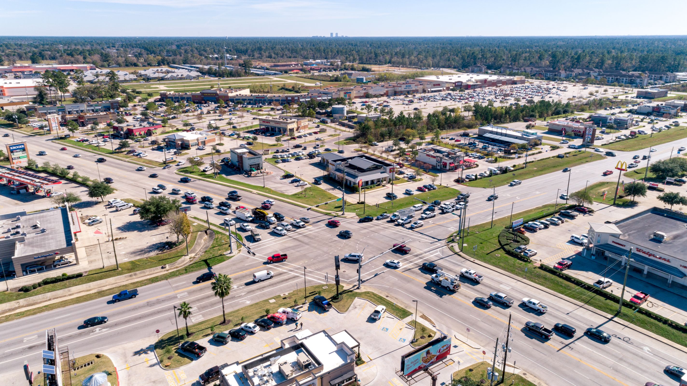
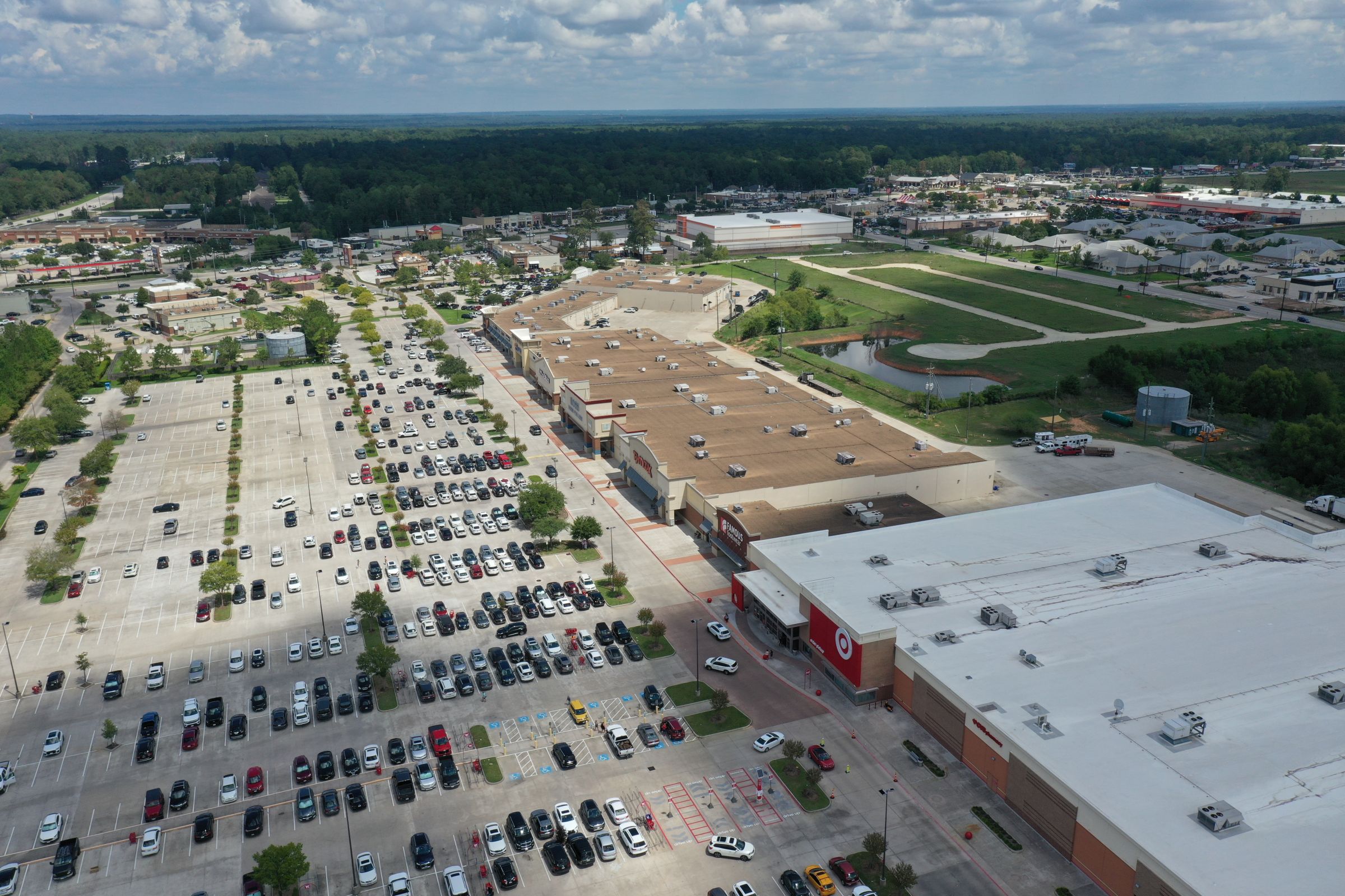
The District is actively supporting diverse economic development activities within its boundaries. Retail shopping and dining are major economic draws. In addition to retail, our largest sectors primed for growth are hospitality, construction, health care, and educational services. The overarching goal is for the District to be a destination people want and need to spend time in. That way, everybody wins.
The major employers in Montgomery County are Conroe ISD, HEB Grocery, Kroger, Magnolia ISD, Medical Center Hospital, Montgomery County, New Caney ISD, Walmart, and Willis ISD. In addition, nearly 2,000 business establishments are within a 10-minute drive from the District.
The District’s location 45 minutes north of Houston in Southeast Texas provides businesses with easy access to major transportation routes, along with access to major international airports and one of the largest ports in the world. Additionally, the regional airport in Conroe extended its runway to 8,000 feet and has added Customs facilities for international arrivals. Explore all of the details of our logistical advantage!
A mouse click away is an interactive map displaying degrees conferred by program within a chosen radius of WMPID. Top universities in our region include the University of Houston, Lone Star College System, Houston Community College, Sam Houston State University, and San Jacinto Community College.
Here you can layer the WMPID map with the data of your choosing to create a heat map: a graphical representation of data that uses a system of color coding to represent different values. As an example, you can filter the population to determine the best location for your business in terms of the population served. For instance, filtering for age distribution can help you determine the most advantageous location for a daycare.
Site selectors and businesses can also use our GIS Planning tools to determine flood zones, District limits, hospitals, proximity to secondary education, and more.
Did you know WMPID funds and completes infrastructure projects that benefit businesses, landowners, and community members within the District? As a partnership between local governments and the state, WMPID focuses exclusively on local projects. Road improvements, public safety, and beautification projects all are part of our mission. Explore our completed projects to understand and appreciate our scope of work.
Energy, natural gas, communications, and water services providers can be found here. For your convenience, a link to a map for water and sewer utilities by address is also provided. Go to https://www.westwoodmpid.org/data-center/infrastructure and click on the red button.
.jpg)
Links to your customized GIS maps can be obtained by clicking the red “Share Report” button in the map's top right corner.
.jpg)
Webpages such as “Targeted Businesses” that are text-based can be added to a shareable custom report using the instructions found here. The “Add to Report” button is at the bottom of the page.
Data-based decision management highlights a pathway to constant, incremental improvement that can enhance the overall performance and efficiency of a business. It lends consistency to business practices that allow for collaborations and successful forecasts and predictions. It’s why we offer free tools.
GIS planning tools put the power of data within reach, but if you need more help with planning, market research, and scouting talent, don’t hesitate to contact WMPID today! Please follow us on LinkedIn for current news and project updates.
.jpg)

$4,356
The amount of Conroe city property tax you save per million dollars of property valuation. Members of WMPID are exempt from annexation by Conroe.
4
Sheriff’s Deputies and 5 patrol cars. The Improvement District employs additional police in patrolling our district. Our law enforcement efforts help our businesses to succeed.
$0
WMPID charges zero property tax and provides infrastructure for the future of members’ business. Our revenue is a small portion of sales tax charged on local retail sales.
$3,000
The District has grown to nearly 3000 acres of mostly commercial land that encompasses the region between Conroe, Magnolia and The Woodlands, serving infrastructure needs in the area, in partnership with Precinct 2.